Why your Valhalla turn-by-turn distances are wrong: a distance-axis mismatch
2026-07-28
I build an offline motorcycle navigation app. It routes on-device with Valhalla, snaps the rider's GPS onto the route, and shows the usual "in 300 m, turn left." For weeks the turn distances were subtly, maddeningly wrong: the "200 m" callout would fire when I was clearly 350 m from the junction, or a turn would announce late. The instructions themselves were correct. The distances were not.
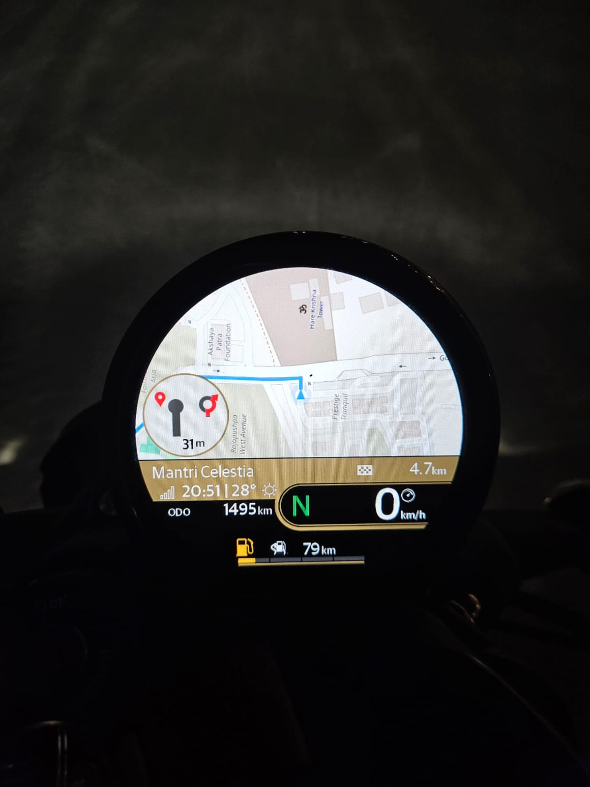
Offline Valhalla routing projected onto the bike's cluster. The map renders great, the route is right, but that turn distance is on the wrong ruler.
The root cause turned out to be a units/axis mismatch that is easy to introduce, produces plausible-looking-but-wrong output, and that I have not seen written down anywhere. If you are doing client-side navigation on top of Valhalla (or OSRM, or any routing engine), this will save you the debugging session I had.
Two different rulers
A routed trip gives you two things that both measure "distance along the route," but on different rulers:
-
Per-maneuver
length. Valhalla tells you each maneuver's road length in kilometers. Sum these and you get the road-network distance: the true driving distance along the actual roads. -
The geometry polyline, an encoded polyline of shape points. The distance you get by walking those points with the haversine formula is the straight-line-between-vertices distance. On a sparse polyline through curves, this is shorter than the true road length, because the polyline chords cut the corners the real road takes.
These two numbers are not equal. For a curvy route they can differ by several percent. And here is the trap: your live map-matcher snaps onto the polyline.
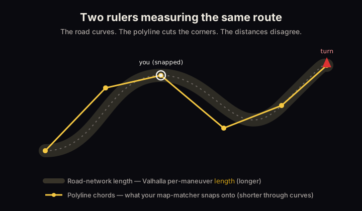
Same route, two rulers. The road length (grey) is longer than the polyline chords (gold) your matcher tracks.
Why the mismatch produces wrong callouts
Live navigation works like this: each GPS fix, you find the nearest point on the route polyline and
compute how far along the polyline you are. Call that traveled. Then distance-to-next-turn is:
distanceToTurn = maneuver.cumulativeMeters - traveled
traveled is measured on the haversine polyline ruler because that is the geometry you snapped
onto. So maneuver.cumulativeMeters MUST be on the same ruler. If you built it by summing
Valhalla's per-maneuver length (the road-network ruler), you are subtracting two numbers measured
with different rulers. The result is garbage that happens to look like a distance.
Concretely: say a maneuver is 1000 m along the road but the polyline chord distance to it is 940 m.
If cumulativeMeters = 1000 (road ruler) and your snap says traveled = 200 (polyline ruler), you
compute 800 m to the turn. But the rider is actually 740 m away on the polyline you are tracking.
The error grows with route curviness and compounds over the trip.
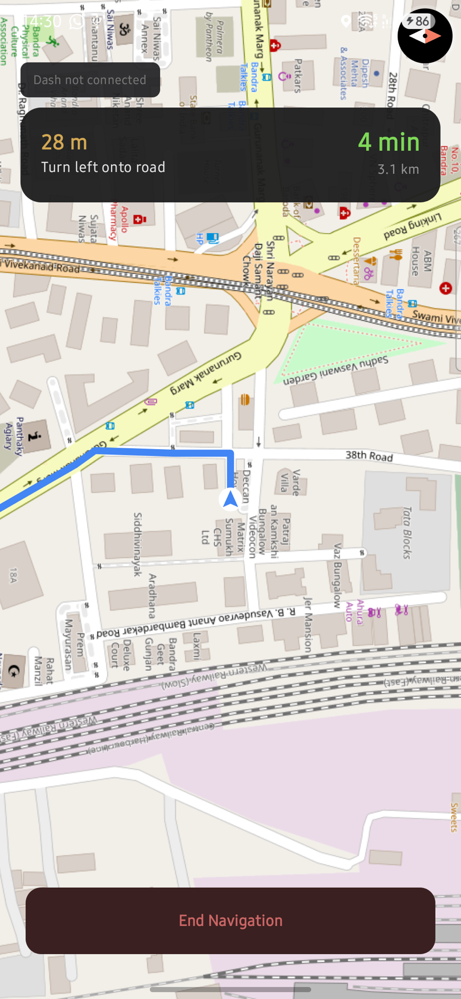
Live turn-by-turn on the phone. The "distance to turn" number is the value this whole post is about.
The fix: pick one ruler and use it everywhere
The map-matcher's ruler is not negotiable, so everything else must move onto it. Place each maneuver on the haversine polyline axis using its shape index, not its road length.
Valhalla gives you begin_shape_index on each maneuver: the index into that leg's shape where the
maneuver begins. So:
- Decode the full geometry (remember Valhalla shape is precision 6, not the usual 5).
- Build a cumulative haversine distance array over the shape vertices, once.
- For each maneuver, look up
cumulative[begin_shape_index]. That is its distance-to-here on the same ruler the matcher uses.
// One distance axis: haversine cumulative distance at each shape vertex.
val cumulative = DoubleArray(geometry.size)
for (i in 1 until geometry.size) {
    cumulative[i] = cumulative[i - 1] + haversineMeters(geometry[i - 1], geometry[i])
}

// Place each maneuver on THAT axis via its shape index, not via Valhalla's road-length `length`.
val maneuvers = rawManeuvers.map { m ->
    Maneuver(
        instruction = m.instruction,
        cumulativeMeters = cumulative[m.beginShapeIndex.coerceIn(0, cumulative.lastIndex)],
    )
}

// Total distance for remaining/ETA math: also the polyline total, NOT summary.length.
val totalMeters = cumulative.last()
Now maneuver.cumulativeMeters - traveled is a subtraction of two numbers on the same ruler, and
distance-to-turn is correct. Arrival and remaining-distance math get consistent for free, because
they are all on the polyline axis too. (Keep Valhalla's length around if you like, for display or
diagnostics; just do not mix it into the matcher math.)
Two gotchas worth calling out
begin_shape_indexis per-leg and inclusive. If you concatenate multiple legs into one geometry array, offset each leg's indices by where that leg started in the combined array.- Precision 6. Decoding Valhalla's polyline with the default precision-5 factor silently puts every point in the wrong place. Ten-times-off coordinates. Use precision 6 for Valhalla.
Why "it looked roughly right" hid the bug
This class of bug is nasty precisely because both rulers produce distances: positive numbers in the right ballpark. On a straight highway the two rulers nearly agree, so it works. It is only on curves, roundabouts, and dense urban turns that the gap opens up, which is exactly where accurate turn distances matter most. If your nav "mostly works but the turn callouts feel off," check whether your maneuver distances and your snapped-progress distance are measured on the same ruler.
Pin it down with a unit test: feed a canned Valhalla response through your parser and assert that a
maneuver's cumulativeMeters equals the hand-computed haversine cumulative at its shape index. If
those two ever diverge, you have a two-ruler bug.
@Test
fun `maneuver distance sits on the haversine axis, not Valhalla road-length`() {
    val route = parseTrip(cannedValhallaResponse)   // your parser
    val turn = route.maneuvers.first { it.type == TURN }
    // Expected: haversine cumulative at the maneuver's begin_shape_index.
    val expected = route.cumulative[turn.beginShapeIndex]
    assertEquals(expected, turn.cumulativeMeters, 0.5)
    // And the trip total is the polyline total, not summary.length:
    assertEquals(route.cumulative.last(), route.totalMeters, 0.001)
}
Written while building an offline nav app on Valhalla. The fix is one idea: the live map-matcher defines the distance axis, so every other distance must live on it.
If you do offline maps on the JVM/Android, I also wrote a small dependency-free PMTiles reader: pmtiles-kotlin.